 পিএমইন্ডিয়া


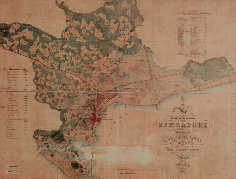
সিঙ্গাপুরের প্রধানমন্ত্রীকে ১৮৪৯ সালের সিঙ্গাপুর দ্বীপের একটি প্রাচীন মানচিত্রের প্রতিলিপি উপহার দিলেন ভারতের প্রধানমন্ত্রী শ্রী নরেন্দ্র মোদী। ১৮৪২-৪৫ সময়কালের এক সমীক্ষার ভিত্তিতে এই মানচিত্রটি প্রস্তুত করা হয়।
জাতীয় পুরাতত্ত্ব বিভাগ, নয়াদিল্লির সংগ্রহশালায় রক্ষিত এই মানচিত্রটির একটি প্রতিলিপি মুদ্রণ করে তুলে দেওয়া হল সিঙ্গাপুরের প্রধানমন্ত্রীর হাতে।
PG/SKD/DM/S
Presented PM @leehsienloong a reproduction of a map of the island of Singapore dating back to 1849. pic.twitter.com/Can6vnurOP
— Narendra Modi (@narendramodi) November 24, 2015Measuring 52in x 52in and based on a survey that was done during 1842-45, the map depicts topographical details of parts of Singapore.
— NarendraModi(@narendramodi) November 24, 2015The map also depicts a description of various points in the vicinity of Singapore town above the level of low water spring tides.
— NarendraModi(@narendramodi) November 24, 2015The reproduction was done from the cartographic collection of the National Archives of India, New Delhi. https://t.co/lu2nPOQGXQ
— NarendraModi(@narendramodi) November 24, 2015


