 PMINDIA


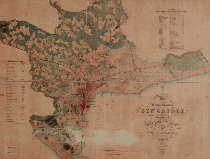
The Prime Minister today presented Singapore Prime Minister H. E. Mr Lee Hsien Loong a reproduction of a map of the island of Singapore dating back to 1849. Measuring 52in x 52in and based on a survey that was done during 1842-45, the map depicts topographical details and description of various points in the vicinity of Singapore town above the level of low water spring tides. The reproduction was done from the cartographic collection of the National Archives of India, New Delhi.
Presented PM @leehsienloong a reproduction of a map of the island of Singapore dating back to 1849. pic.twitter.com/Can6vnurOP
— Narendra Modi (@narendramodi) November 24, 2015Measuring 52in x 52in and based on a survey that was done during 1842-45, the map depicts topographical details of parts of Singapore.
— NarendraModi(@narendramodi) November 24, 2015The map also depicts a description of various points in the vicinity of Singapore town above the level of low water spring tides.
— NarendraModi(@narendramodi) November 24, 2015The reproduction was done from the cartographic collection of the National Archives of India, New Delhi. https://t.co/lu2nPOQGXQ
— NarendraModi(@narendramodi) November 24, 2015


 [
[